Your tax dollars have been used over the years to fund the USGS and its many projects. Many of you are no doubt familiar with the ever popular 7.5′ topo map, or quad map, that is commonly sold in map stores for about $6 each. These maps are great for exploring and 4 wheelin’. These 1:24000 scale maps provide good detail and the 20′ contour lines yield a good view of the terrain once you get use to reading them.
However….buying these little maps at $6 a pop gets expensive. Unfolded, they suck up the better part of a Jeep’s hood and if it is windy out, an ample supply of rocks is needed as corner paper weights. The USGS has scanned these thousands of maps on an electronic scanner and with some appropriate reference data files, made them available to the general public in the form of Digitized Raster Graphic (DRG) images. The price was originally quite reasonable, but some bean counter in the government decided they could sell us the results of our tax dollars for well over $100 per CD. NOT VERY NICE FOLKS!!!
Luckily, these DRG CDs can be legally copied by anyone since the data on them is public domain (remember, our tax dollars funded these projects). A number of companies have started selling these CDs on the Internet and some have actually gotten into some pretty good price wars. Be careful though….as many companies also use the maps from these CDs and combine them with their own software. Obviously these CDs can not be legally copied. When these commercial companies do this, they usually do something to the data files so that these map images only work with their software.
Each USGS CD has 64 of these 7.5′ topo maps on them, which make up a grid of 8×8 maps. These CDs also contain two 1:100,000 scale maps and a 1:250,000 scale map. What makes these CDs so easy to use is that all of these topos come with the necessary data files that OziExplorer reads so that it can auto-calibrate each map. What does this mean to you? You simply load the map reference files from the CD and it is ready to use…no muss, no fuss! The scanned images remain on the CD, unless you have BIG hard drives (Some lap tops may have the HD capacity to store a state’s worth of files.)
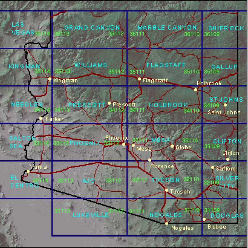
The graphic below shows the state of Arizona and the major 1 x 2 grids that cover it. Each of these 1 x 2 grids are covered by 2 CDs. I have written the CD lat/long numbers in green at the east and west borders of the blue grids. For example, Grand Canyon is covered by 36113 and 36112.